Madrid (EFE).- Temperatures will soar this first weekend of summer above 40 degrees due to “a warm episode that could become” the first heat wave “of the summer period, since “the values will continue rising in the next few days in most of Spain ”, according to Aemet.
As of Sunday and until Wednesday, temperatures between 5 and 10 degrees above normal for the season could be reached in large areas of the center and south of the peninsula, which will be the areas most affected by the heat, Rubén added this Friday. del Campo, spokesman for the State Meteorological Agency (Aemet).
The causes of these high temperatures are due to several concurrent factors; On the one hand, he explained, a stable atmosphere with high pressures that will make the sun shine for many hours, thereby heating up the lower layers of the atmosphere and leaving the heat “trapped” near the ground because the air will barely move.
According to the Aemet spokesman, temperatures near the ground will be very high, “with a warming that we could describe as autochthonous, that is, from the area where we live.”
Arrival of a very warm air mass from Africa
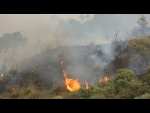
Added to this is the arrival of a very warm air mass from North Africa that will further increase temperatures, with no precipitation expected, except for an occasional storm in mountain areas.
This Friday the temperatures will rise especially in the western half, with records of up to 4 degrees more than Thursday in the early afternoon.
It will reach 38 or 39 degrees in Badajoz, Seville or Córdoba, forecasts that keep the communities of Extremadura and Andalusia on alert, in the latter case, in orange, due to a significant meteorological risk.
On Saturday the rise in temperatures will be widespread, both maximum and minimum, and the rise will be notable in the Cantabrian Sea, where they may register 6 degrees more than on Friday.

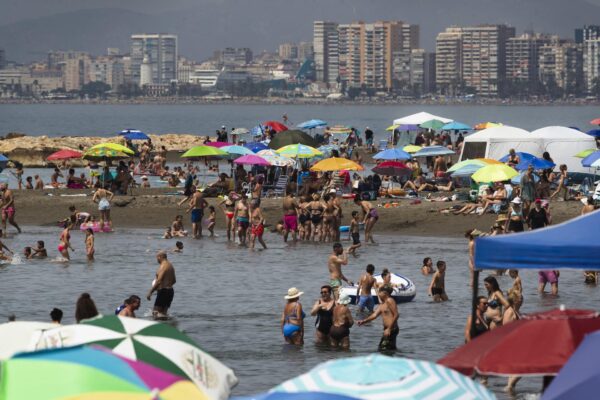
It will be a very hot day in cities like Oviedo or Coruña, which may exceed 32 degrees and could also exceed 35 degrees in the south of Galicia, areas of Castilla y León, the Ebro valley, a large part of Extremadura, Madrid, western Castilla La Mancha and Andalusia.
Thermometers will exceed 40º in the Guadiana and Guadalquivir valleys; In cities like Badajoz, Seville or Córdoba “the danger due to high temperatures will be significant” both on Saturday and the day after, according to Rubén del Campo.
On Sunday the escalation of temperatures will continue
On Sunday the escalation of temperatures will continue, especially in the east of the peninsula, although in the north they will drop “remarkably”, from 6 to 8 degrees, which will affect Galicia, Asturias and Cantabria, where it is expected that it will not exceed 25 degrees.
In the rest of the country the heat will be very intense that day, with more than 35 degrees in the afternoon in much of the center and south of the peninsula, as well as in the Ebro depression and large areas of the northern plateau.
Cities like Madrid, Granada, Huelva, Lleida, Cáceres, Toledo or Zaragoza will reach maximums of between 38 and 40 degrees.
Once again, the Guadiana and Guadalquivir valleys will be “authentic peninsular ovens”, according to Rubén del Campo, with records even higher than 42 degrees in cities such as Badajoz, Córdoba or Seville.
On Monday temperatures in the northern third will drop by up to 6 degrees compared to the previous day, specifically in points of Burgos, the Basque Country and Navarra.
On the contrary, 40 degrees will be exceeded not only in the Guadiana and Guadalquivir valleys, but also in other areas of the southern half; in Madrid it could be around 39 degrees, and on Monday it could reach 40 degrees in Toledo, Ciudad Real or Jaén, and 42 degrees or more in Seville, Córdoba and Badajoz.
The night heat will be pronounced on that date and it may not drop below 23 or 24 degrees in Almería, Barcelona, Cádiz, Málaga or Seville; during the day it will again exceed 35 degrees in large areas of the center and south of the peninsula, as well as in the Ebro depression.
During Tuesday and Wednesday there will be hardly any changes, and it will be from Thursday when the temperatures drop, with a more pronounced drop in the northern half, although the heat will continue in the center and south will stop being so intense and will adjust more to the time of the year.