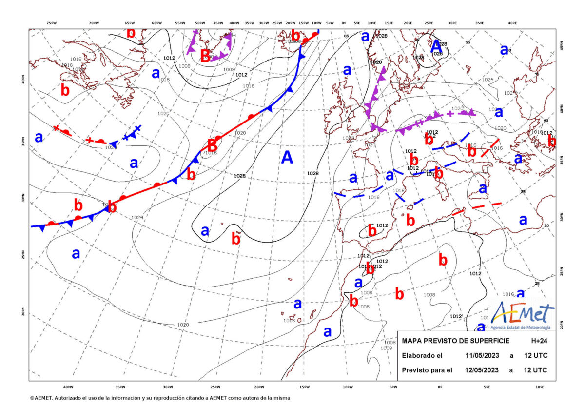
Madrid, May 11 (EFE).- Tomorrow, Friday, there will be rain, showers and some storms that may be persistent on the eastern Cantabrian coast and north of Navarra, rainfall that may be locally strong in large areas of the extreme eastern peninsula and the Balearic Islands, and with a general drop in temperatures, according to the State Meteorological Agency (Aemet).
In the eastern Mediterranean area and the Balearic Islands there will be showers and storms, which could be locally strong, mainly in the northeast of Catalonia, the Balearic Islands and inland areas of the Valencian Community.
With this meteorological situation, the Aemet has put the Balearic Islands, Cantabria, Catalonia, Navarra, the Basque Country and the Valencian Community on yellow notice.
In the rest of the Peninsula there will be a possibility of showers or storms, more likely in the Northern plateau and environments of the Central and Iberian systems, except in the southwest, where there will be little cloudiness.
The snow level will be around 1,400/1,600 meters in the northern third of the peninsula and above 1,800 meters in the center, with weak frosts in mountainous systems in the northern half of the peninsula.
In the Canary Islands there will be intervals of low clouds in the north of the islands, with some high clouds, and trade winds with strong intervals.
The temperatures, both the minimum and the maximum, will drop in an almost general way in most of the country.
The wind will blow from the north and northwest in most of the Peninsula, with a north wind in the Ebro, and from the northeast and east in the south of the Mediterranean area.
PREDICTION BY AUTONOMOUS COMMUNITIES:
– GALICIA: Cloudy or covered, decreasing at intervals or slightly cloudy at the end of the day in the southern half. Light rains and showers in the north, which could spread to the center of the Community during the central hours and which will be scattered and less likely in the south. Minimum temperatures with few changes and maximums in slight decrease. North component wind, tending to northeast at the end.
– ASTURIAS: Cloudy or overcast, with rains and showers, more intense and persistent on the eastern coast. The snow level will be around 1,400-1,500 meters. Minimum temperatures with few changes and maximums in slight decrease. Light wind from the north component.
– CANTABRIA: cloudy or overcast, with rain and showers, more intense and persistent on the coast during the first half of the day. The snow level will be around 1,400-1,500 meters. Minimum temperatures without significant changes; the maximum in slight descent. Northwest wind tending to north in the afternoon.
– BASQUE COUNTRY: cloudy or overcast, with rain and showers, more intense and persistent on the coast in the first half of the day. Temperatures without significant changes. Northwest winds, tending to north in the afternoon.
– CASTILLA Y LEÓN: banks of low clouds at dawn in the north and northeast that will favor the formation of fog and mist, preferably in mountainous areas. They will extend towards the southern third, with little cloudy skies predominating in the rest. Towards noon the cloudiness will increase, with abundant growth of evolution cloudiness. In the last hours the cloudiness will withdraw, once again forming banks of low clouds in the Cantabrian and Iberian regions.
Scattered showers likely, occasionally accompanied by thunderstorms. The snow level will be around 1,600-1,800 meters. Minimum temperatures with few changes and decreasing maximums. Weak frosts at high mountain levels. North and northeast wind, increasing in intensity.
– NAVARRE: cloudy or overcast in the center and north, with rain and showers in the northwest and the Pyrenees at the beginning of the day, without ruling out an isolated shower in the afternoon in the rest. Temperatures without significant changes. Northwest wind increasing its intensity during the morning in the Ribera.
– LA RIOJA: morning banks of low clouds that will favor the formation of fog and mist, especially in mountainous areas. From noon the cloudiness will increase, coinciding with the development of evolution cloudiness. In the last hours, low-type cloudiness will increase again. Probable scattered precipitation, more frequent in the afternoon, when it will be in the form of a shower, and occasionally accompanied by a storm.
The snow level is around 1,600-1,800 meters. Temperatures with slight changes. Weak frosts in high altitudes of the Iberian. North and northwest wind.
– ARAGÓN: in the Pyrenees, cloudy skies with probable weak precipitations in the divide. In the rest, little cloudy in the morning, tending to cloudy skies in general from noon with cloudiness of diurnal evolution. As of noon, probability of showers with occasional storms in the northern third and in the Iberian System and without ruling out in isolation in the rest.
The snow level is around 1,500 meters in the Pyrenees and 1,600-1,800 meters in the Iberian System. Temperatures in slight decrease or without changes. In the Ebro depression, a moderate northwesterly wind and in the rest, from the north and northwest, light to moderate.
– CATALONIA: cloudy intervals and cloudy or covered skies from noon due to cloudiness of diurnal evolution. Generalized showers are expected in the eastern half in the afternoon, which can be locally strong and accompanied by storms, especially in the eastern half and in Tarragona. The snow level between 1,600 and 1,800 meters.
Falling temperatures. At the extremes of the coastline, a moderate north and northwest wind with strong intervals in the morning and in the rest, a weak west component wind with moderate intervals, turning generally at noon to the east and southeast loose with intervals of moderate and tending at the end of the day to loose variable.
– EXTREMADURA: slightly cloudy, with low-development evolution cloudiness in the mountains to the north and east of Cáceres. Minimum temperatures with few changes and maximum temperatures in slight to moderate decrease, without ruling out some isolated frost in high altitudes of Gredos. Northerly winds, increasing in intensity during the second half of the day.
– COMMUNITY OF MADRID: intervals of low cloudiness in the Sierra at dawn, with mist or probability of a fog bank at high altitudes, and little cloudiness in the rest, increasing the evolutionary cloudiness intervals throughout the Community.
Probability of showers in the afternoon -occasionally stormy and that could bring hail- in the Sierra area, they will be unlikely in the rest. The snow level between 1,800 meters and 2,200 meters. Minimum temperatures in decline in high areas of the Sierra and with slight changes in the rest; descending highs. Light wind from the north component with more intense intervals in central hours of the day.
– CASTILLA-LA MANCHA: cloudy at first in the southeast and eastern end of the Community, with a predominance of low cloudiness and some morning mists and little cloudiness in the rest, increasing the evolution cloudiness intervals from the east. Probability of rain and showers that can be accompanied by storms in the eastern third and in high areas of the northwest, which can be locally strong in the extreme east of Albacete.
The snow level will be between 1,800 meters and 2,200 meters in the northwest of the Community. Minimum temperatures in decline in areas of La Mancha and with slight changes in the rest and maximum in decline. Light wind from the north component, with more intense intervals in the afternoon.
– VALENCIAN COMMUNITY: cloudy intervals and cloudy skies or covered with evolution cloudiness from noon. Isolated showers are expected, more widespread from noon, locally strong and accompanied by a storm, especially in the interior of Valencia and Alicante.
Falling temperatures. In the north of Castellón, moderate northwest wind decreasing to light in the afternoon; in the rest of the coast, moderate east and northeast wind and in the rest, predominance of the east and south components with some moderate interval.
– REGION OF MURCIA: cloudy, increasing under cover, with showers accompanied by storms, which can be locally strong during the afternoon. Decreasing temperatures and easterly winds, increasing on the coast in the afternoon.
– BALEARIC ISLANDS: cloudy intervals tending to cloudy or overcast, with showers that can be locally strong and be accompanied by storms and small hail. Temperatures with few changes or a slight decrease. Variable light wind, increasing in Ibiza and Formentera to the north component and tending to the east and northeast in the afternoon throughout the archipelago, with coastal breezes in Mallorca.
– ANDALUSIA: in the eastern third, intervals of cloudy skies, tending to cloudy skies or covered with showers, more probable and intense from the afternoon and in the eastern end, where they will be occasionally accompanied by storms and may be locally strong. Intervals of low clouds in the rest of the Mediterranean slope, without ruling out some weak and occasional precipitation. Little cloudy skies in the rest of the community. Falling temperatures, locally unchanged. Winds from the east on the Mediterranean coast and from the north on the rest, tending to the southwest on the Atlantic coast.
– CANARY ISLANDS: in the north of the islands with greater relief, cloudy intervals, opening clear at noon and increasing to cloudy in the last hours with a low probability of occasional drizzle. In the rest, little cloudy, except for some high cloudiness, tending at the end of the day to cloudy intervals in Lanzarote and Fuerteventura.
Low probability of light haze in height over the eastern islands. Temperatures in general decrease, being able to be more pronounced in the maximum of interior areas. Moderate to strong northeast wind, with very strong gusts on the southeast and northwest slopes of the higher relief islands.