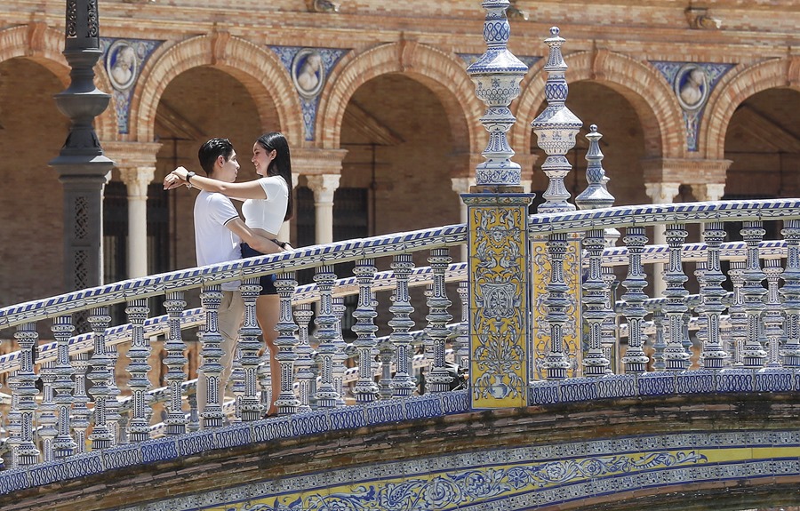
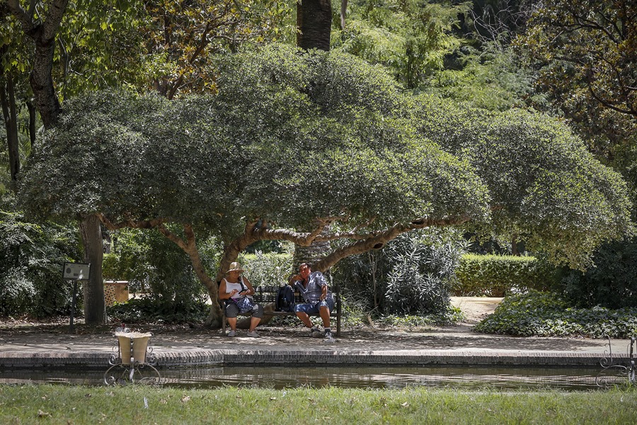
Madrid, June 26 (EFE).- The first heat wave of this summer keeps eight communities on alert this Monday – Aragón, both Castillas, Catalonia, Extremadura, Madrid, the Valencian Community and Andalusia, with special intensity in the latter, where there is a red warning (extreme risk) for maximums that will register up to 44 degrees.
In Andalusia there is a red alert in the Cordoba and Seville countryside with values that will rise to 44 degrees, in a time slot between 1:00 p.m. and 9:00 p.m., reports Aemet, who also warns that in the provinces of Cádiz, Granada and Huelva have an orange level (risk) for maximums between 39-43 degrees.
Extremadura has an orange notice throughout the community for daytime values between 39-42 degrees, at a time between 1:00 p.m. and 9:00 p.m., and for minimums that will reach 22 degrees.
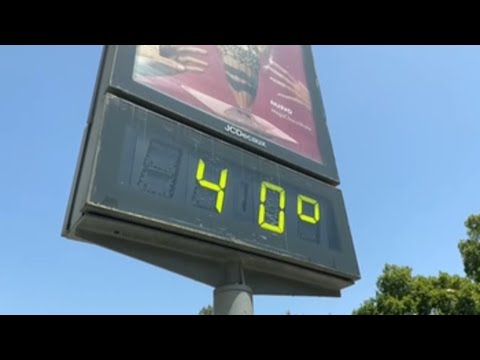
The Community of Madrid will also be affected by the suffocating heat with values that will reach 40 degrees in the south, Las Vegas and the west; In the metropolitan area and Henares, up to 39 degrees are expected and in areas of the mountains it will reach 37 degrees in locations below 1,000 meters.
In the communities of Aragon, both Castillas, Catalonia and in the Valencian Community there is a yellow warning (risk) for storms or rain and for maximums that will oscillate between 34-39 degrees.
As a consequence of the intense heat of the next few days, Aemet recommends carefully following the indications of the “National Plan of Preventive Actions of the effects of excess temperatures on health” on the web: https://www.sanidad.gob.es/ excessTemperatures2023/consult.do
Likewise, it warns that with the red alert the meteorological risk is extreme with meteorological phenomena of exceptional intensity and with a very high level of risk for the population, while with the orange alert there is a significant risk in unusual meteorological phenomena and with a certain degree dangerous for usual activities.
It will exceed 36-38 degrees in large areas of the southern half of the peninsula, as well as in areas of the northeast; and it will even exceed 40 in the southwest quadrant, especially in the valleys.
The minimums will drop in the northwestern half of the peninsula, but will increase in the rest; they will be around 20 degrees on the Mediterranean coasts and in the southwest quadrant.
Levante wind will blow in Alborán and in the Strait and with strong intervals; Tramontana in Ampurdán and north wind in the Ebro; from the north and northeast in the northwest quadrant of the peninsula, more intensely on the coasts and in areas of the northern plateau; while the western component will predominate in the rest of the Atlantic slope, as well as the regime of breezes in the Mediterranean coasts; in the northern Canary Islands.

Galicia
Cloudy sky with low clouds in the north of Lugo and cloudy intervals in the rest except on the south coast and in the mountains of Ourense with a predominance of clear skies; big clearings will open in the morning in the southern half. Probable morning mists and fog banks in high areas of Lugo and western Ourense. Persistent light rains in A Mariña that in a dispersed and occasional way could spread to points on the rest of the north coast.
Minimum temperatures decreasing in the southeast and without changes in the rest and maximum temperatures decreasing in the northeast and with little change in the rest. Wind from the north and northeast that will be weak in the interior south and with strong intervals in the Fisterra area.
Asturias
Cloudy or covered with low clouds, with probable morning mists and fog banks, especially at high altitudes, and drizzles and light rains. Temperatures without changes or in slight decrease that will be more pronounced of the minimums in points of the southwest and of the maximums in the eastern interior. Loose north wind that will soon turn northeast and that will intensify on the coast.
cantabria
Skies covered with low clouds and light rain and drizzle unlikely in the far south. Probable morning mists and fog banks at high altitudes in the southwest. Temperatures in minimum without changes or in slight decrease, which will be more pronounced, and even locally notable, than the maximum of the interior. Light wind with a predominance of the northern component in the interior and that will tend to the northeast in the entire community in the morning.
Basque Country
Cloudy or covered with low clouds with light rain and drizzle that will not reach the south of Álava and that subsides during the afternoon. Minimum temperatures without changes or in a slight decrease that will be more pronounced than the maximum in the interior. Loose north wind.
Castile and Leon
Intervals of low morning clouds in mountainous areas of the north and northeast, with a predominance of little cloudy or clear skies in the rest. Possible growth of evolutionary cloudiness in the northern third and around Iberia, where storms may occur, generally with little precipitation.
Minimum temperatures with few changes or a slight decrease; highs in significant decline in the northeast and hardly any changes in the rest. Northeast wind in the northern half and variable in the south. During stormy events, strong gusts may be recorded.
Navarra
Little cloudy in the Ribera del Ebro and in the rest, cloudy or cloudy intervals. Probably light rains in the northwest, which will subside during the afternoon. Minimum temperatures without changes or in slight decrease that will be more pronounced than the maximum. Loose north and northwest wind with Cierzo in the Ribera Baja and more intense intervals in the rest during the central hours, except in the western third.
The Rioja
Intervals of low clouds in the morning and late hours, with a predominance of slightly cloudy skies for the rest of the day.
Evolution cloudiness during the central hours of the day in Iberia, where storms are not ruled out, generally with little precipitation and occasionally with hail. Minimum temperatures with few changes and decreasing maximums. Wind from the northwest and north, somewhat more intense in the Rioja Baja in the afternoon. During stormy events, very strong gusts may be recorded.

Aragon
Predominance of clear skies, with a tendency to cloudiness intervals of diurnal evolution in the Iberian System and the Pyrenees during the second half of the day. Showers and storms are expected that may be locally strong in the Iberian System of Teruel, and will be likely with less frequency and intensity in the southwest of Zaragoza and the eastern third of the Pyrenees.
Minimum temperatures in decline in the province of Zaragoza and slight rise or no changes in the rest; decreasing maximums, although reaching significantly high values in the east of Zaragoza and the south of Huesa. Northwest wind in the Ebro valley and variable loose in the rest.
Catalonia
Clear skies, with diurnal cloudiness in the afternoon, with locally strong showers and storms in the interior of the northern half. Minimum temperatures on the rise and maximum temperatures on the north coast of Tarragona and slight decrease or no changes in the rest, which will continue the significantly high values in the central depression, southern pre-coastal and Ampurdán.
Northwest wind at the northern end of the coast and variable loose in the rest, with a southern component in the afternoon and intervals of greater intensity on the Tarragona coast.
Estremadura
Little cloudy sky. Scattered and occasional storms are not ruled out in the afternoon, generally dry, in areas where there is growing cloudiness of evolution. Slight presence of calima in the south.
Temperatures will experience little change; They will exceed 40 degrees in general. The nights will be warm, with minimum values around 22 degrees. Variable light wind, with a tendency to establish the western component in the afternoon. In the event of stormy phenomena, very strong gusts may be recorded.
Madrid
Clear with some evolving cloudiness in the central hours of the day and without ruling out a scattered shower or occasional storm in the Sierra. Temperatures with slight changes with maximums that will exceed 39 degrees in the Tagus and Jarama valley and 36 in low areas of the Sierra and minimums above 20. Variable light wind with more intense intervals associated with storms.
Castilla la Mancha
Clear with evolving cloudiness in the central hours of the day. Scattered showers and occasional storms are not ruled out in high areas of the western half and throughout the eastern half, being more likely in the Central and Iberian systems and in La Mancha de Cuenca and Albacete.
Temperatures with slight changes with predominance of increases in the minimum of Cuenca and Albacete. Highs that will exceed 38 degrees in a large part of the provinces of Toledo and Ciudad Real and even 40 occasionally in the Tagus and Guadiana valleys and minimums above 20 degrees. Variable light wind with more intense intervals associated with storms.
Valencian Community
Clear sky, with cloudiness of diurnal evolution in the interior in the afternoon. Probable showers and storms in the interior of Castellón and Valencia the second half of the day, which could be locally strong. Minimum temperatures on the rise and maximum temperatures on a slight decrease, which will continue with significantly high values in the province of Valencia. Light variable wind, with breezes in the afternoon and intervals of greater intensity on the central coast.
Murcia
Little cloudy sky. Cloudiness of daytime evolution in the mountains, without ruling out some isolated storm in the north of the region. Rising minimum temperatures; maximum without changes or in slight descent. Light variable wind, with breezes.
baleares
Little cloudy or clear skies. Temperatures with few changes or a slight rise. Light wind with coastal breezes.
Andalusia
Clear skies with cloudiness of daytime evolution in the mountains, without ruling out an isolated storm in the eastern interior. Rising minimum temperatures; maximum without changes or in slight ascent. East wind on the Almería coast and the Strait; weak variable in the rest, with a tendency in the western third to a western component in the afternoon.
Canary Islands
Little cloudy or clear in general, with cloudy intervals in low areas of the north. Calima that will mainly affect the eastern islands and Tenerife, being more significant in the midlands and highlands.
Minimum temperatures in slight ascent and maximum in general ascent, being able to become notable in interior areas. It can reach 34 ºC in the interior of Lanzarote and Fuerteventura and 32 ºC in the middle of Gran Canaria and Tenerife. Light wind from the north component. In high areas, a moderate to strong wind from the southeast, with very strong gusts at the peaks of Tenerife that can exceed 90 km/h.