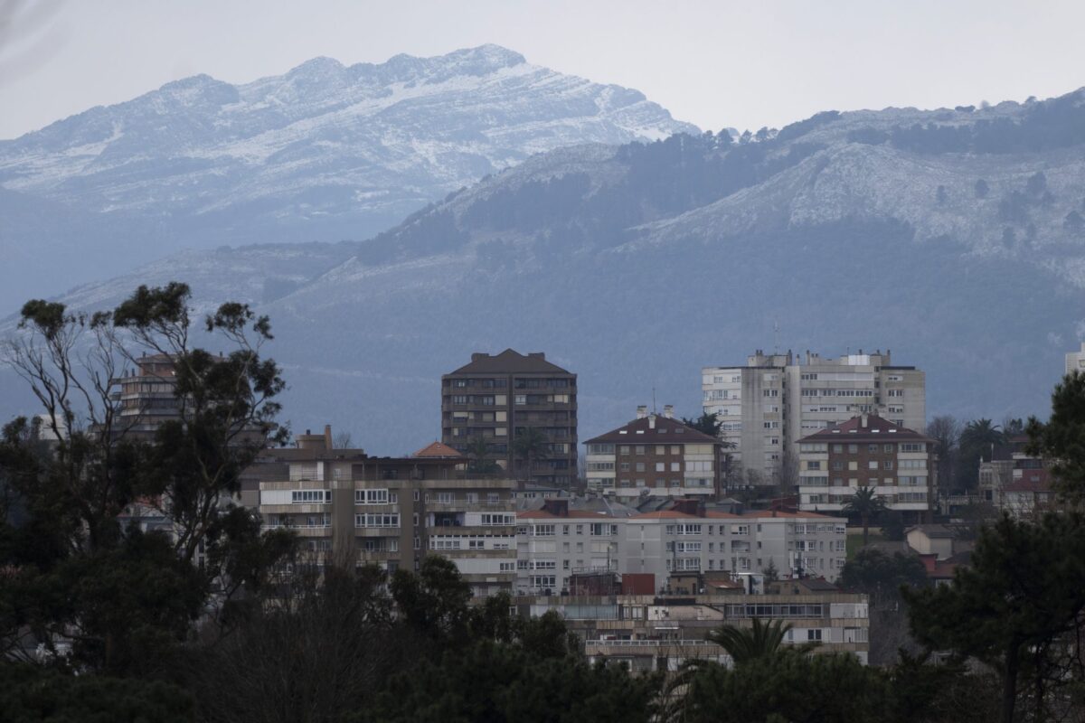
Santander (EFE).- The low temperatures that affect Cantabria have not left images of snow on the coast in the end, leaving those white prints on the peaks and in the highest areas of the region, although the northeast wind has given “a high feeling of cold” that marked the day.
The notice this Monday from the State Meteorological Agency (Aemet) pointed out that the cold below zero degrees in a large part of the autonomous community could leave snow on the coast in the first days of the week.
Yes, it has been seen, from the coastal areas, the summits of the snow-capped mountains, in the midst of cold air that has reflected a lower thermal sensation than the one indicated by the thermometer.
However, after Tuesday’s day, the Aemet regional delegate, José Luis Arteche, told EFE that it is no longer expected to see snow on the coast, although small amounts are expected to fall on the intermediate and lower eastern levels.
Arteche explains that the combination between the Juliette storm, which has mainly affected the Mediterranean coast and the Balearic Islands, and an anticyclone have left a great sensation of cold in Cantabria due to the air coming from the northeast, although the temperatures have not been so low.
No snow on the coast, but inland
Cantabria has registered a maximum temperature of 9.3 degrees in San Vicente de la Barquera, with similar values along the entire coast, while the interior and high areas such as Alto Campoo, which at dawn marked a temperature of -7.2 degrees, They have been the coldest.
Rainfall has also been more abundant in the Liébana area, falling 4.6 millimeters in Camaleño with data updated at 3:00 p.m., or in Alto Campoo.

The interior of Cantabria and the Villaverde valley maintain the yellow warning for this Wednesday due to accumulation of snow from 500 meters, which according to Aemet data could accumulate up to 4 centimeters in 24 hours.
The region of Liébana and that of Campoo add to a yellow warning for accumulations of snow of up to five centimeters from 800 meters, another for cold, since negative temperatures are expected up to -6 degrees in the highest peaks.
The Aemet is confident that, as of Thursday, the precipitations in the form of snow in the region will end, to enter a weekend with “cool temperatures” but higher than those of these days.
The meteorological spring starts “really cold”
Arteche appreciates that the Juliette storm has not particularly affected Cantabria, since the Mediterranean coast and the Balearic Islands have registered a lot of accumulated precipitation.
The Juliette storm formed in the Mediterranean has left snowfall at lower levels of the north of the peninsula with numerous affected roads, especially secondary ones and with special intensity in the Balearic Islands, where the alert for extreme risk persists, now due to maritime storms and waves of more than 8 meters.
Almost 500 kilometers of Spanish highways have required this Tuesday chains in certain sections or have been occasionally cut to traffic, especially in mountain areas of Asturias, Aragon, Cantabria, Castilla y León and the Balearic Islands.
Looking ahead to tomorrow, Wednesday, the Aemet forecasts a “really cold” start to the meteorological spring with very low minimum temperatures again. In Cantabria, snowfall is expected from about 200 meters, or occasionally even below.