Sydney (Australia) (EFE)
The local organization Directorate for Civil Security and Risk Management asked the population, through social networks, to evacuate the coastal areas “until the tsunami alert is lifted” and to stay “informed” about what is happening.
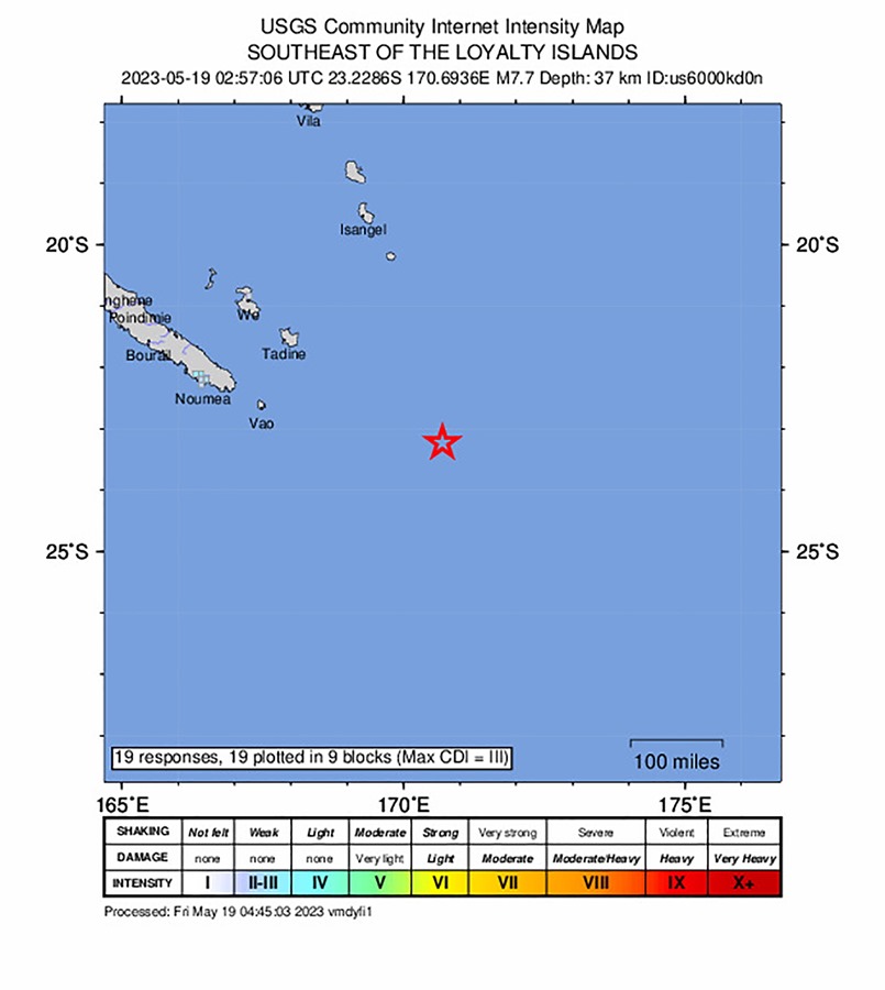
The powerful earthquake, which shook the waters southeast of the Loyalty Islands -in New Caledonia- at around 2:00 p.m. local time (3:00 GMT), triggered a tsunami alert within a radius of 1,000 kilometers around the epicenter, which would include to other nations such as Vanuatu and Fiji.
“Tsunami waves have been observed,” says the Pacific Tsunami Alert Service on its website.
In the latest update, the service noted that the waves could be between 0.3 and 1 meters high when they hit the Vanuatu coast; and less than 0.3 in New Caledonia, Fiji, Kiribati and New Zealand, among other nations.
Earthquake 37 kilometers deep
The United States Geological Survey, which monitors global seismic activity, placed the earthquake at a depth of 37 kilometers under the seabed and 333 kilometers southeast of the town of Vao, on the Isle of Pines – the southernmost of New Caledonia. and 433 kilometers southeast of Isangel, on the island of Tanna in Vanuatu.
For its part, the Australian Meteorological Service indicated that the tsunami could threaten Lord Howe Island, more than 450 kilometers east of the eastern town of Port Macquarie, in the State of New South Wales.
Meanwhile, the New Zealand National Emergency Management Agency indicated on social networks that it “evaluates” the potential threat.
New Caledonia is located near the so-called Pacific Ring of Fire and the submarine volcanoes of the Lau Basin, which is why it regularly registers shocks of seismic origin.