Madrid, Feb 1 (EFE) and in the Balearic Islands.
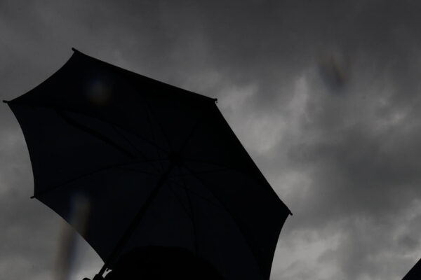
The Aemet also forecasts cloudy skies in the Cantabrian area, upper Ebro, north of the Iberian Peninsula and northeast of the northern plateau, with light and scattered rains in the eastern Cantabrian Sea, which may also occur in neighboring areas but will tend to subside.
It also warns of cloudy intervals in the higher relief Canary Islands, where there is a probability of some weak precipitation, although in the easternmost ones a little cloudy sky is expected.
There may be morning fog banks in the main mountainous systems of the northern half of the peninsula, as well as in the depressions of the northeast, northern plateau and in areas of the Mediterranean coasts. In the Canary Islands, haze is not ruled out in the eastern islands at the end of the day.
The maximum temperatures will not suffer major changes -although the increases will predominate, except in the southeast of the peninsula where they will drop- and the minimum will drop in the southwest of the peninsula, while they will increase in the rest.
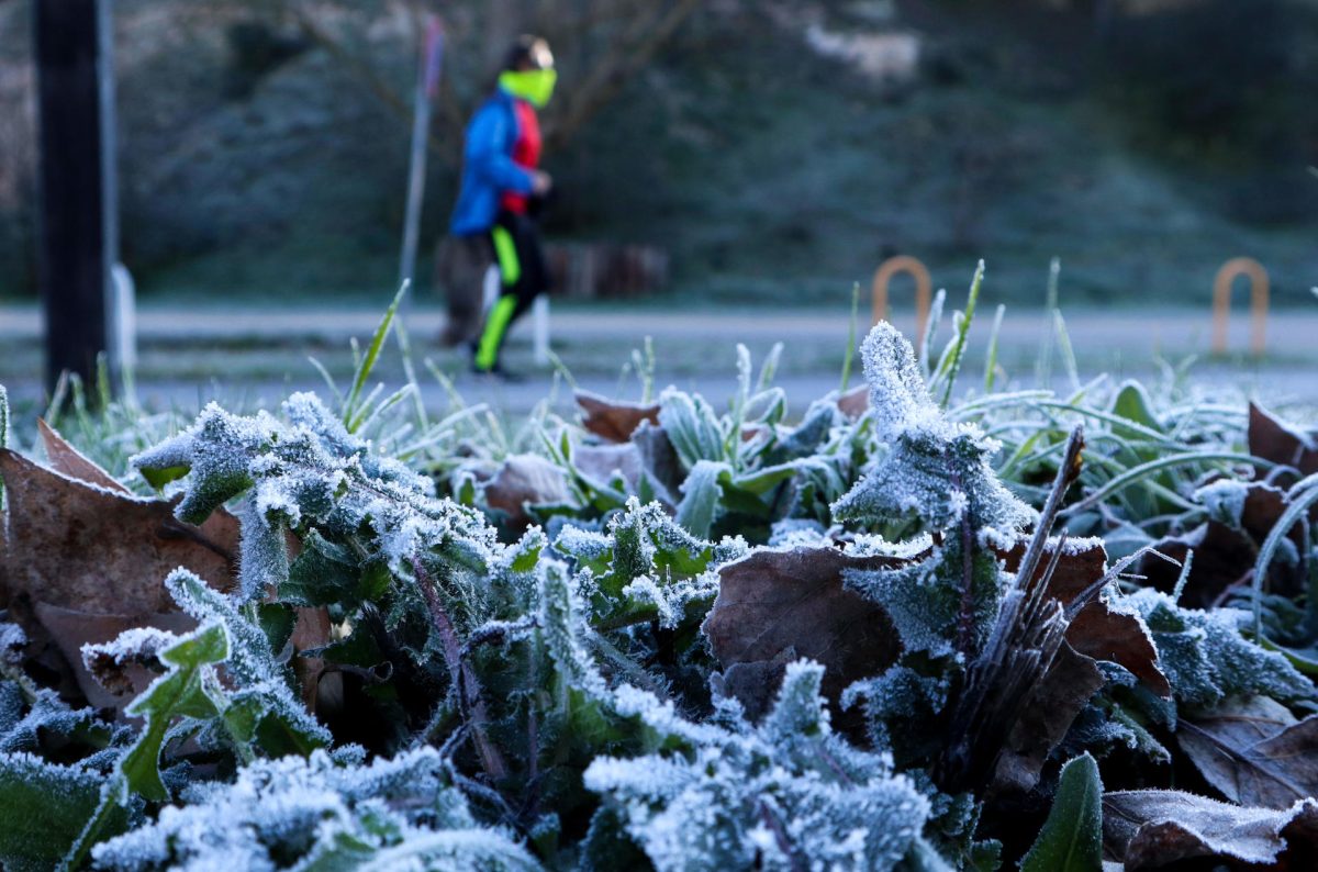
Weak frosts are expected in large areas of the interior of the peninsula and the Balearic Islands, less extensive than those of the previous days and more intense in the main mountain systems and on the plateaus.
The Tramontana wind will blow with strong intervals and very strong gusts in Ampurdán, and less intensely in the north of the Balearic Islands. Closing in the Ebro; lift in the Strait, from the northeast on the coasts of Galicia, and in the rest variable loose wind, with a predominance of the northern component in the northwestern half of the peninsula.
In the Canary Islands, the wind, from the north, will tend to loosen throughout the day and will pick up again at the end in the eastern islands.
PREDICTION BY AUTONOMOUS COMMUNITIES
-GALICIA: low cloudiness in the extreme north, without ruling out light rain -more likely in A Mariña-, cloudy intervals in the rest of the northern half and clear skies in the rest. Minimum temperatures on the rise in the northern half, where the maximum may experience a slight rise. Weak frosts in the southeast quadrant. Loose east and northeast wind, with more intense intervals in the northern interior, and that will intensify on the north coast.
-ASTURIAS: covered with some clearings that will be temporarily opened in the northern third. Mists and probable fog banks at the beginning and end of the day in the Cordillera. Scattered light rains are not ruled out in the eastern third in central hours of the day. Minimum temperatures in slight ascent. Weak frosts in the southern third, more intense in peaks. Variable light wind that at noon will tend to the east and northeast and will intensify on the coast.
-CANTABRIA: cloudy sky, although it will open temporarily clear, especially in the north. Mists and some fog banks at the beginning on the peaks. Light showers the first half of the day, which will be unlikely in the extreme southwest. Low probability of snow, whose elevation will be between 1,000 and 1,400 meters. Rising temperatures, locally notable in the minimum and slight or unchanged in the case of the maximum. Weak frosts at high altitudes in the southwest. Light wind with a predominance of the eastern component in the central hours of the day.
-BASQUE COUNTRY: covered with scattered light rains, which will be somewhat more intense early in the day and less likely in the south. Low probability of snow; the height will be between 1,000 and 1,400 meters. Widespread morning mists and fog banks, mainly inland, and again at night, but with less intensity and extent. Maximum temperatures slightly rising in Vizcaya and Álava. Light wind, with a predominance of north or northeast and some more intense interval on the coast at the beginning.
-CASTILLA Y LEÓN: cloudy skies are expected in the northeast, where some weak scattered precipitations are not ruled out, which may be snow above 1,000 meters; in the rest, cloudy or cloudy intervals that will tend to subside in the afternoon. Scattered mists and mists in the first half of the day, and possibly at night, more widespread in the south. Rising minimum temperatures. Frosts, unlikely in the northeast, more intense in the northwest and in mountainous areas. North component wind and northeast direction.
-NAVARRE: cloudy, although in the afternoon the cloudiness will decrease. Morning and night mists and fog banks in the northwest and locally in the Pyrenees. Light rain likely in the northwest. Temperatures unchanged or slightly rising. Scattered weak frosts in the eastern Pyrenees. Loose north and northwest wind, more intense in the central hours, throughout the community except on the Cantabrian slope.
-LA RIOJA: cloudy, without ruling out some weak rainfall in the Rioja Alta, which may be snow above 1,000 meters, in the afternoon the cloudiness will decrease in the east. Mists and fog banks in mountain areas. Slightly rising temperatures. Weak frosts in Iberia. Winds from the northwest and north, more intense in the Iberian and Rioja Baja.
-ARAGÓN: predominance of slightly cloudy or clear skies, with intervals of low cloudiness in the Iberian system and the Ebro depression in the morning, with mists and fog banks, freezing in some points and without ruling out that they are locally persistent in the south from Huesca. Slightly rising temperatures. Frosts in the Iberian system and in Huesca; locally strong, especially in the valley bottoms of the Pyrenees. Weak wind from the west component, with intervals of greater intensity in the Ebro valley in the central hours of the day.
-CATALONIA: predominance of slightly cloudy or clear skies, with intervals of low cloudiness, mists and fog banks in the central depression, which will be locally icy and persistent in Lleida. Rising temperatures, light in the case of maximum. Frosts in large areas of the interior; stronger in the northern third, especially in the valley bottoms of the Pyrenees. Northeast wind in the Ampurdán, with strong intervals in the far north; In the rest, a weak west component wind, with somewhat more intense northwest intervals in the south of Tarragona.
-EXTREMADURA: clear sky with some cloudy intervals in northern mountain areas. Morning mists and fog banks are not ruled out. Minimum temperatures unchanged or slightly rising. Weak frosts, widespread in Badajoz, where locally they can be more intense. Light northeast wind.
-COMMUNITY OF MADRID: clear sky with some interval of low clouds in the morning. Rising minimum temperatures. Widespread weak frosts that will be more intense in the south and southeast valleys and in Somosierra. Northeast wind, loose in general.
-CASTILLA-LA MANCHA: slightly cloudy with intervals of low clouds in the morning in Guadalajara, which may be accompanied by some mist or scattered fog in very high areas. Minimum temperatures without changes or on a slight rise that will be more pronounced in Guadalajara except in the Iberian and in the summits of the Central system. Generalized weak frosts, more intense in a large part of La Mancha de Toledo, Ciudad Real and Cuenca, the Tagus and Guadiana valleys and in mountainous areas of the northeast. Loose wind with a predominance of the east component and northeast direction.
-VALENCIA COMMUNITY: clear sky although in the morning there may be intervals of low cloudiness, mists and fog banks in the interior, which are not ruled out in points of the southern coast. Frosts inside, generally weak. Light variable wind, with a predominance of the west component the first half of the day, and that will turn east in the afternoon on the coast.
-REGION OF MURCIA: clear with intervals of low clouds at dusk. Minimum temperatures in slight ascent, with weak frosts inside; maximum without changes on the coast and in decline in the interior. Light east component wind in Campo de Cartagena, and variable light in the rest.
-BALEARIC ISLANDS: predominance of slightly cloudy skies. Weak frosts in Mallorca and Ibiza. West component wind, loose in general.
-ANDALUSIA: clear skies except in the area of the Strait, where intervals of cloudy skies are expected. Minimum temperatures falling in the western third and rising in the rest, with frosts in the interior, generally weak; maximum with slight changes. Variable light wind, with a predominance of the eastern component. Levante on the Mediterranean coast and the Strait area.
-CANARY ISLANDS: in Lanzarote and Fuerteventura, little cloudy skies in general, with a cloudy period and light rains during the central hours of the day, which will give way to a slight haze in the afternoon, which will increase at the end of the day. In the rest of the islands, cloudy in the north, with a low probability of light rain, although clearings will open from noon. On the southern slopes of the higher relief islands it will tend to be cloudy with some probable showers during the central hours. Temperatures with few changes, with probable weak frosts in the peaks of Tenerife and La Palma. North component wind that will go from light to moderate and that will turn southeast in Lanzarote and Fuerteventura.